Topic: BatzS - Romani
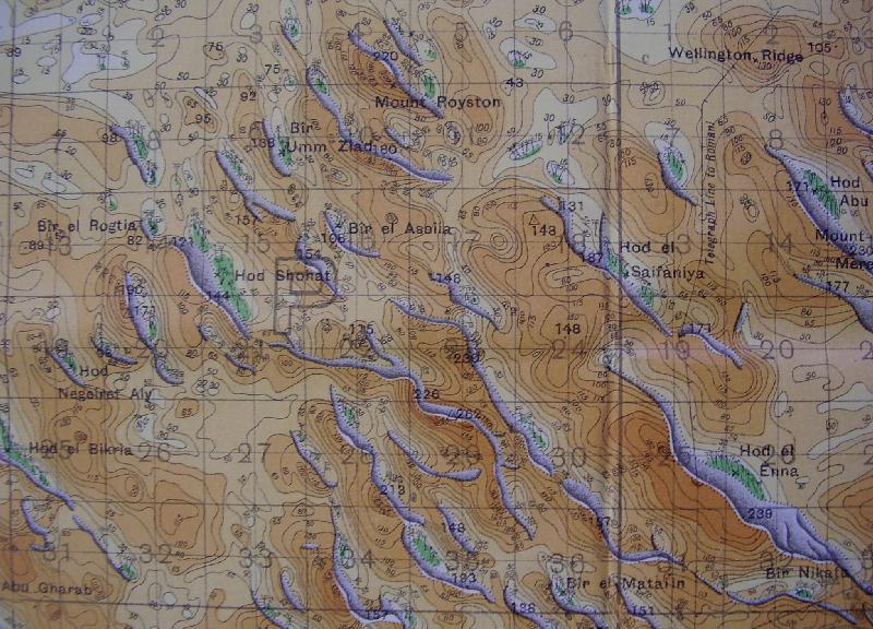
1:40,000 Map, GSGS 4012, Qatia 006, 23 December 1916, Mt Royston
Area around Mt Royston
The above map was drawn up after the Battle of Romani. It was used for troops patrolling the region subsequent to the fall of El Arish in December 1916. Its main purpose is to illustrate the terrain over which the Battle of Romani was fought. This part of the map segment deals specifically with the Mount Royston region, an area over which the Light Horse fought against the Ottoman Army. Wellington Ridge, Mount Meredith and Hod Enna are to the extreme right of this map.
Calculating distances on this map is simple. Each square is 1,000 yards by a 1,000 yards.
Additional Reading:
Index of Romani and outlying area maps
Full index of accounts on this site regarding the Battle of Romani
Citation: 1:40,000 map of Mt Royston area


