Topic: BatzP - Beersheba
In ascertaining the nature of the landscape traversed by the horses and men of the 4th Light Horse Brigade as they charged towards Beersheba, below are two reasonably contemporary photographs of the location. They were taken in 2006 and are published by courtesy of Gal Shane.
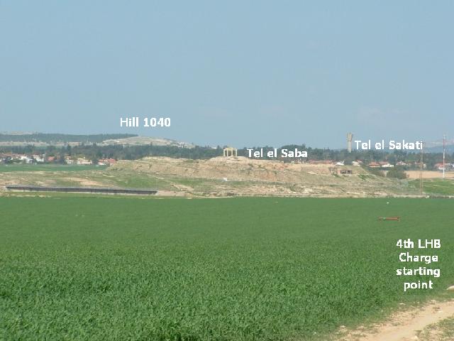
The 4th Light Horse Brigade formed up around this point prior to the charge
[Click on photograph for a larger version.]
This contemporary photograph clearly illustrates the terrain encountered by the men of the 4th Light Horse Brigade as they prepared for the famous charge. The important feature to note is the imposing hill in this photograph called Tel el Saba. Once seen in photographic form, it becomes self evident why the charge could not occur prior to the taking of Tel el Saba by the Auckland Mounted Rifles. The redoubt dominates the plain. While the Turks occupied Tel el Saba with about 300 men and 8 machine guns, any movement on this plain would have been subject to savage and devastating enfilading fire. However, once taken, the danger from the flanks was removed allowing Chauvel to order the charge.
[Click on photograph for a larger version.]
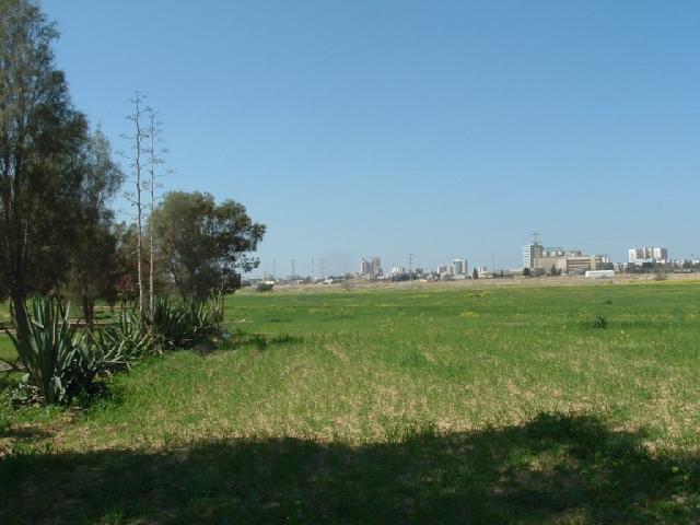
The camera has now been swivelled 90 degrees to face Beersheba. It was over this tract of land that the charge occurred. This is ideal cavalry terrain with soft slopes and open territory.
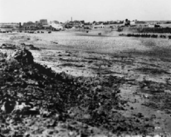
To contrast this with the scene at Beersheba in November 1917, a photograph taken by Brigadier General LC Wilson, GOC 3rd LHB, illustrates the view of the charge path.
Beersheba, November 1917
Citation: Pictures (taken 2006) of the route taken by the 4th LHB charge at Beersheba


